
7 William's Place Upper

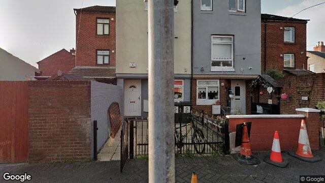
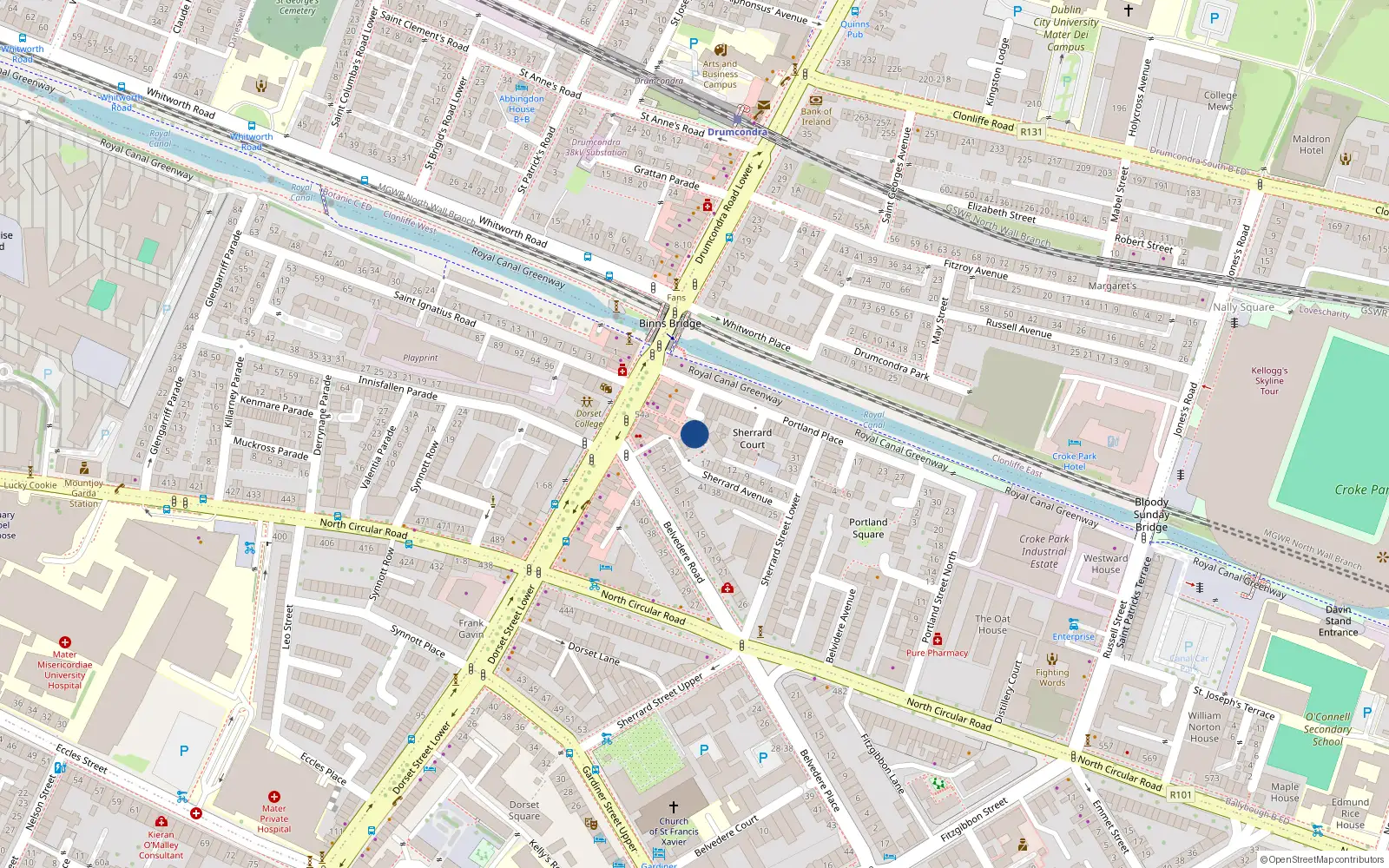
Dublin 1 / Dorset Street Lower / D01F5P6

Last Sale Price

€265,000
House Second-Hand 2 recorded sales 4.3 yrs tracked
vs Dublin 1
-3.6%
Median €275,000
3,909 sales
Growth +6.3%/yr · 15.2 yrs
Nearby Properties
Loading map…

Sale History

2 sales
€265,000
7 yrs, 3 mo ago
Second-Hand Dwelling house /Apartment
+€167,000 (+170.4%) over 4.3 yrs
€98,000
11 yrs, 7 mo ago
Second-Hand Dwelling house /Apartment

Overall: +170.4% from €98,000 to €265,000 ()


Price History

Loading chart…

Price Intelligence

This property has been sold 2 times since 30 Jul 2014. The price has increased by +170.4% from €98,000 to €265,000. That works out to an annualised return of +26.0% over 4.3 years.

What did 7 William's Place Upper last sell for?

7 William's Place Upper last sold for €265,000 on 6 Nov 2018.

How many times has 7 William's Place Upper been sold?

7 William's Place Upper has been sold 2 times between 30 Jul 2014 and 6 Nov 2018. The price increased by 170.4% over that period.

Growth metrics use repeat-sale properties only. Methodology.

Dorset Street Lower streetscape

About Dorset Street Lower

Dorset Street Lower is a neighbourhood in Dublin 1, Dublin.

Area Median
€265,000
1 sales
District Median
€275,000
3,909 sales
Street Median
€265,000
1 sales

Housing in Dublin 1

Typical Size
57 m²
Typical Build
1999
BER Ratings
A (efficient)G

Based on 11,162 BER assessments — see district details

Related Pages

Debug: Address & Geocode Data

Composed Display Address

7 William's Place Upper, Dublin 1

PPR Source

address 7, WILLIAMS PLACE UPPER, DORSET STREET LOWER DUBLIN 1
canonical_address 7, WILLIAMS PLACE UPPER, DORSET STREET LOWER DUBLIN 1
eircode (PPR)
property_id f0f1c61592141a1b4256f408bb326349f2252447
region dublin-01
format_display_address() 7, Williams Place Upper, Dorset Street Lower Dublin 1

Parsed Address (URL Gen)

district dublin-01
district_display Dublin 1
area dorset-street-lower
area_display Dorset Street Lower
street william-s-place-upper
street_display William S Place Upper
house_number 7
slug 7-williams-place-upper-dorset-street-lower
is_apartment false

Geocode Data

source_provider google
source_accuracy ROOFTOP
latitude 53.36076629999999
longitude -6.2592748
formatted_address 7 William's Place Upper, Dublin 1, D01 F5P6, Ireland
eircode (geocode) D01F5P6
locality Dublin 1
county County Dublin
resolution_method conflict_unresolved_google_default
street_number 7
route William's Place Upper
sublocality
address_components
show raw JSON
[{"long_name": "7", "short_name": "7", "types": ["street_number"]}, {"long_name": "William's Place Upper", "short_name": "William's Place Upper", "types": ["route"]}, {"long_name": "Dublin 1", "short_name": "Dublin 1", "types": ["postal_town"]}, {"long_name": "County Dublin", "short_name": "D", "types": ["administrative_area_level_1", "political"]}, {"long_name": "Ireland", "short_name": "IE", "types": ["country", "political"]}, {"long_name": "D01 F5P6", "short_name": "D01 F5P6", "types": ["postal_code"]}]

Provider Geocode Payloads

Google ok
query_text 7, WILLIAMS PLACE UPPER, DORSET STREET LOWER DUBLIN 1, Dublin 1, Ireland
fetched_at 2026-02-18T13:37:10Z
formatted_address 7 William's Place Upper, Dublin 1, D01 F5P6, Ireland
eircode D01F5P6
locality Dublin 1
county County Dublin
street_number 7
route William's Place Upper
sublocality
latitude 53.36076629999999
longitude -6.2592748
address_components
show raw JSON
[
  {
    "long_name": "7",
    "short_name": "7",
    "types": [
      "street_number"
    ]
  },
  {
    "long_name": "William's Place Upper",
    "short_name": "William's Place Upper",
    "types": [
      "route"
    ]
  },
  {
    "long_name": "Dublin 1",
    "short_name": "Dublin 1",
    "types": [
      "postal_town"
    ]
  },
  {
    "long_name": "County Dublin",
    "short_name": "D",
    "types": [
      "administrative_area_level_1",
      "political"
    ]
  },
  {
    "long_name": "Ireland",
    "short_name": "IE",
    "types": [
      "country",
      "political"
    ]
  },
  {
    "long_name": "D01 F5P6",
    "short_name": "D01 F5P6",
    "types": [
      "postal_code"
    ]
  }
]
raw_payload
show raw JSON
{
  "accuracy": "ROOFTOP",
  "address_components": [
    {
      "long_name": "7",
      "short_name": "7",
      "types": [
        "street_number"
      ]
    },
    {
      "long_name": "William's Place Upper",
      "short_name": "William's Place Upper",
      "types": [
        "route"
      ]
    },
    {
      "long_name": "Dublin 1",
      "short_name": "Dublin 1",
      "types": [
        "postal_town"
      ]
    },
    {
      "long_name": "County Dublin",
      "short_name": "D",
      "types": [
        "administrative_area_level_1",
        "political"
      ]
    },
    {
      "long_name": "Ireland",
      "short_name": "IE",
      "types": [
        "country",
        "political"
      ]
    },
    {
      "long_name": "D01 F5P6",
      "short_name": "D01 F5P6",
      "types": [
        "postal_code"
      ]
    }
  ],
  "country_code": "ie",
  "county": "County Dublin",
  "eircode": "D01F5P6",
  "formatted_address": "7 William's Place Upper, Dublin 1, D01 F5P6, Ireland",
  "lat": 53.36076629999999,
  "locality": "Dublin 1",
  "lon": -6.2592748,
  "place_id": "ChIJgVSCvnwOZ0gR4xDKUo409YA",
  "provider": "google",
  "route": "William's Place Upper",
  "street_number": "7",
  "sublocality": ""
}
Nominatim ok
query_text structured:7, Dublin 1, Ireland
fetched_at 2026-02-12T21:55:40Z
formatted_address Dublin Road, Fingal, County Dublin, Leinster, K45 XV34, Éire / Ireland
eircode K45XV34
locality
county County Dublin
street_number
route Dublin Road
sublocality
latitude 53.5090485
longitude -6.1825556
address_components
show raw JSON
{
  "ISO3166-2-lvl5": "IE-L",
  "ISO3166-2-lvl6": "IE-D",
  "country": "\u00c9ire / Ireland",
  "country_code": "ie",
  "county": "County Dublin",
  "municipality": "Fingal",
  "postcode": "K45 XV34",
  "region": "Leinster",
  "road": "Dublin Road"
}
raw_payload
show raw JSON
{
  "accuracy": "secondary",
  "address_components": {
    "ISO3166-2-lvl5": "IE-L",
    "ISO3166-2-lvl6": "IE-D",
    "country": "\u00c9ire / Ireland",
    "country_code": "ie",
    "county": "County Dublin",
    "municipality": "Fingal",
    "postcode": "K45 XV34",
    "region": "Leinster",
    "road": "Dublin Road"
  },
  "country_code": "ie",
  "county": "County Dublin",
  "eircode": "K45XV34",
  "formatted_address": "Dublin Road, Fingal, County Dublin, Leinster, K45 XV34, \u00c9ire / Ireland",
  "lat": 53.5090485,
  "locality": "",
  "lon": -6.1825556,
  "place_id": "399698847",
  "provider": "nominatim",
  "route": "Dublin Road",
  "street_number": "",
  "sublocality": ""
}

Composition Path

Route-based street_number + route + sublocality/locality

Eircode Resolution

PPR eircode
Geocode eircode D01F5P6
best_eircode (used) D01F5P6

BER Data (no BER match)

No BER data matched for this property.

Computed Metrics

property_type Second-Hand
dwelling_type House
size_description None
holding_years 4.3
annualized_pct 26.0
vs_street_median_pct None
street_median 265000
street_sample_size 1
street_is_reliable false
vs_area_median_pct None
area_median 265000
area_sample_size 1
area_is_reliable false
vs_district_median_pct -3.6
district_median 275000
district_sample_size 3909
district_is_reliable true
street_growth_rate_pct 26.0
street_growth_years 4.3
street_growth_sample_size 1
area_growth_rate_pct 26.0
area_growth_years 4.3
area_growth_sample_size 1
district_growth_rate_pct 6.3
district_growth_years 15.2
district_growth_sample_size 371
nearby_avg_price None
nearby_price_range None
nearby_count 0