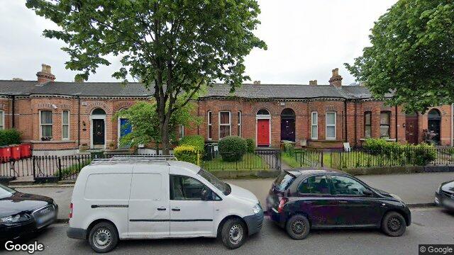
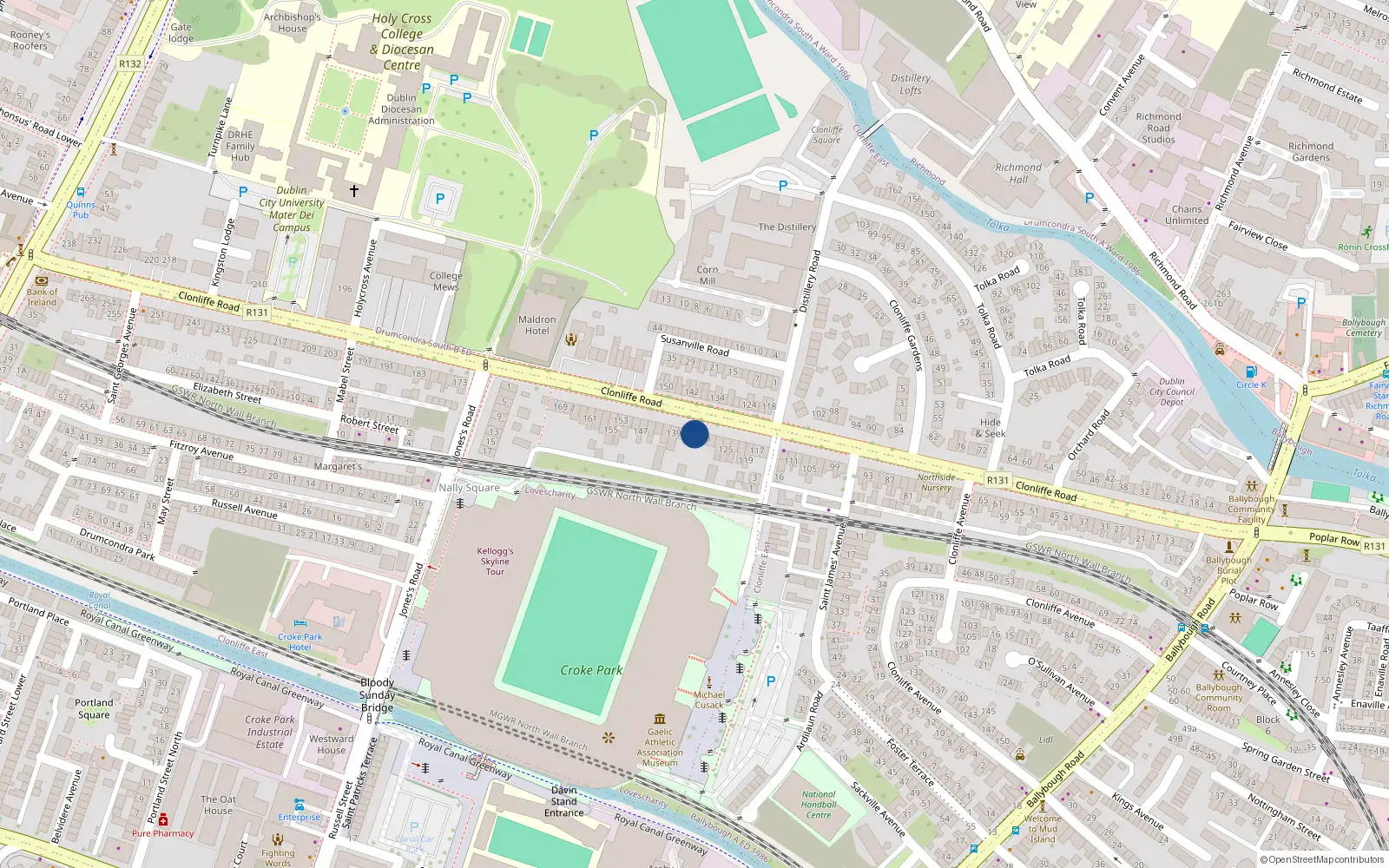
133 Clonliffe Road

Dublin 3 / Drumcondra / D03CY58

Last Sale Price

€710,000
House Second-Hand 2 recorded sales 4.4 yrs tracked
vs Street
+63.2%
Median €435,000
93 sales
Growth +9.1%/yr · 11.4 yrs
vs Drumcondra
+91.9%
Median €370,000
803 sales
Growth +8.1%/yr · 15.3 yrs
vs Dublin 3
+75.8%
Median €403,881
5,998 sales
Growth +6.5%/yr · 16.0 yrs
Street View near 133 Clonliffe Road, Dublin 3, Dublin
Nearby Properties
Loading map…

Sale History

2 sales
€710,000
10 months ago
Second-Hand Dwelling house /Apartment
+€315,000 (+79.7%) over 4.4 yrs
€395,000
5 yrs, 3 mo ago
Second-Hand Dwelling house /Apartment

Overall: +79.7% from €395,000 to €710,000 ()


Price History

Loading chart…

Price Intelligence

This property has been sold 2 times since 23 Nov 2020. The price has increased by +79.7% from €395,000 to €710,000. That works out to an annualised return of +14.3% over 4.4 years.

At €710,000, 133 Clonliffe Road last sold 63.2% above the Clonliffe Road street median of €435,000 (based on 93 recorded sales). Compared to Drumcondra overall (median €370,000, 803 sales), 133 Clonliffe Road sits 91.9% above the area average.

Repeat-sale properties on Clonliffe Road show a median investment growth rate of +9.1% per year over 11.4 years (2014 to 2025, 17 repeat-sale properties).

Street Rank
Top 14%
of 93 properties
Area Rank
Top 7%
of 803 properties
€26,500 Street range €2,943,385
This property: €710,000
What did 133 Clonliffe Road last sell for?

133 Clonliffe Road last sold for €710,000 on 25 Apr 2025.

How many times has 133 Clonliffe Road been sold?

133 Clonliffe Road has been sold 2 times between 23 Nov 2020 and 25 Apr 2025. The price increased by 79.7% over that period.

How does 133 Clonliffe Road compare to others near Clonliffe Road?

At €710,000, 133 Clonliffe Road last sold 63.2% above the Clonliffe Road street median of €435,000 (based on 93 recorded sales).

How does 133 Clonliffe Road compare to the rest of Drumcondra?

Compared to Drumcondra (median €370,000, 803 sales), 133 Clonliffe Road sits 91.9% above the area average.

What is the investment growth rate on Clonliffe Road?

Using properties on Clonliffe Road with at least two recorded sales, the median annual growth rate is +9.1% per year over 11.4 years (2014 to 2025, 17 repeat-sale properties). How this is calculated.

Growth metrics use repeat-sale properties only. Methodology.
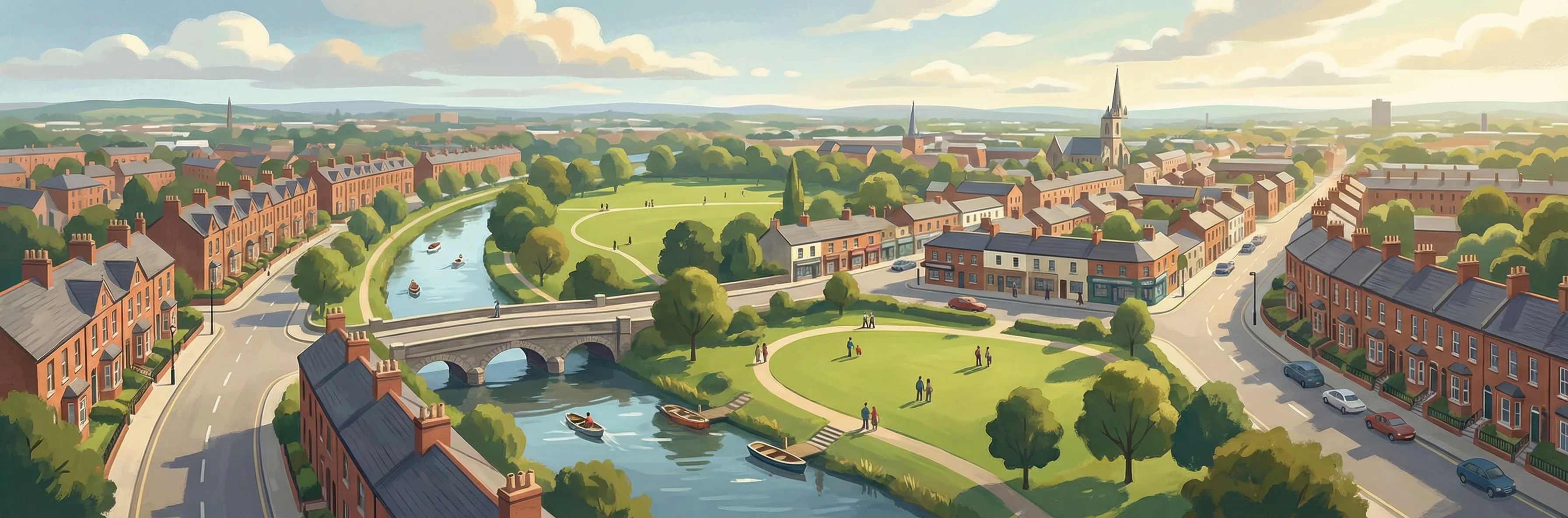
Drumcondra streetscape

About Drumcondra

Drumcondra is a neighbourhood in Dublin 3, Dublin.

Area Median
€370,000
803 sales
District Median
€403,881
5,998 sales
Street Median
€435,000
93 sales

Housing in Dublin 3

Typical Size
80 m²
Typical Build
1959
BER Ratings
A (efficient)G

Based on 11,869 BER assessments — see district details

Related Pages

Debug: Address & Geocode Data

Composed Display Address

133 Clonliffe Road, Dublin 3, Dublin

PPR Source

address 133 CLONLIFFE RD, DUBLIN 3, DUBLIN
canonical_address 133 CLONLIFFE RD, DUBLIN 3, DUBLIN
eircode (PPR) D03CY58
property_id e6341e8eedecfa232da28ef35185f07d624d70e7
region dublin-03
format_display_address() 133 Clonliffe Road, Dublin 3, Dublin

Parsed Address (URL Gen)

district dublin-03
district_display Dublin 3
area drumcondra
area_display Drumcondra
street clonliffe-road
street_display Clonliffe Road
house_number 133
slug 133-clonliffe-rd-dublin-3-dublin
is_apartment false

Geocode Data

source_provider google
source_accuracy APPROXIMATE
latitude 53.3620949
longitude -6.249707
formatted_address Drumcondra, Dublin, Co. Dublin, D03 CY58, Ireland
eircode (geocode) D03CY58
locality Dublin
county County Dublin
resolution_method conflict_unresolved_google_default
street_number
route
sublocality
address_components
show raw JSON
[{"long_name": "D03 CY58", "short_name": "D03 CY58", "types": ["postal_code"]}, {"long_name": "Drumcondra", "short_name": "Drumcondra", "types": ["neighborhood", "political"]}, {"long_name": "Dublin", "short_name": "Dublin", "types": ["locality", "political"]}, {"long_name": "County Dublin", "short_name": "D", "types": ["administrative_area_level_1", "political"]}, {"long_name": "Ireland", "short_name": "IE", "types": ["country", "political"]}]

Provider Geocode Payloads

Google ok
query_text D03CY58, Ireland
fetched_at 2026-02-13T16:03:47Z
formatted_address Drumcondra, Dublin, Co. Dublin, D03 CY58, Ireland
eircode D03CY58
locality Dublin
county County Dublin
street_number
route
sublocality
latitude 53.3620949
longitude -6.249707
address_components
show raw JSON
[
  {
    "long_name": "D03 CY58",
    "short_name": "D03 CY58",
    "types": [
      "postal_code"
    ]
  },
  {
    "long_name": "Drumcondra",
    "short_name": "Drumcondra",
    "types": [
      "neighborhood",
      "political"
    ]
  },
  {
    "long_name": "Dublin",
    "short_name": "Dublin",
    "types": [
      "locality",
      "political"
    ]
  },
  {
    "long_name": "County Dublin",
    "short_name": "D",
    "types": [
      "administrative_area_level_1",
      "political"
    ]
  },
  {
    "long_name": "Ireland",
    "short_name": "IE",
    "types": [
      "country",
      "political"
    ]
  }
]
raw_payload
show raw JSON
{
  "accuracy": "APPROXIMATE",
  "address_components": [
    {
      "long_name": "D03 CY58",
      "short_name": "D03 CY58",
      "types": [
        "postal_code"
      ]
    },
    {
      "long_name": "Drumcondra",
      "short_name": "Drumcondra",
      "types": [
        "neighborhood",
        "political"
      ]
    },
    {
      "long_name": "Dublin",
      "short_name": "Dublin",
      "types": [
        "locality",
        "political"
      ]
    },
    {
      "long_name": "County Dublin",
      "short_name": "D",
      "types": [
        "administrative_area_level_1",
        "political"
      ]
    },
    {
      "long_name": "Ireland",
      "short_name": "IE",
      "types": [
        "country",
        "political"
      ]
    }
  ],
  "country_code": "ie",
  "county": "County Dublin",
  "eircode": "D03CY58",
  "formatted_address": "Drumcondra, Dublin, Co. Dublin, D03 CY58, Ireland",
  "lat": 53.3620949,
  "locality": "Dublin",
  "lon": -6.249707,
  "place_id": "ChIJJ4mGS2EOZ0gRLBywFPbC7GE",
  "provider": "google",
  "route": "",
  "street_number": "",
  "sublocality": ""
}
Nominatim ok
query_text D03CY58, Ireland
fetched_at 2026-02-14T16:26:00Z
formatted_address National Library of Ireland, 7/8, Kildare Street, Mansion House B Ward 1986, Dublin, County Dublin, Leinster, D02 P638, Éire / Ireland
eircode D02P638
locality Dublin
county County Dublin
street_number 7/8
route Kildare Street
sublocality
latitude 53.3411249
longitude -6.2545
address_components
show raw JSON
{
  "ISO3166-2-lvl5": "IE-L",
  "ISO3166-2-lvl6": "IE-D",
  "amenity": "National Library of Ireland",
  "city": "Dublin",
  "city_district": "Mansion House B Ward 1986",
  "country": "\u00c9ire / Ireland",
  "country_code": "ie",
  "county": "County Dublin",
  "house_number": "7/8",
  "postcode": "D02 P638",
  "region": "Leinster",
  "road": "Kildare Street"
}
raw_payload
show raw JSON
{
  "accuracy": "library",
  "address_components": {
    "ISO3166-2-lvl5": "IE-L",
    "ISO3166-2-lvl6": "IE-D",
    "amenity": "National Library of Ireland",
    "city": "Dublin",
    "city_district": "Mansion House B Ward 1986",
    "country": "\u00c9ire / Ireland",
    "country_code": "ie",
    "county": "County Dublin",
    "house_number": "7/8",
    "postcode": "D02 P638",
    "region": "Leinster",
    "road": "Kildare Street"
  },
  "country_code": "ie",
  "county": "County Dublin",
  "eircode": "D02P638",
  "formatted_address": "National Library of Ireland, 7/8, Kildare Street, Mansion House B Ward 1986, Dublin, County Dublin, Leinster, D02 P638, \u00c9ire / Ireland",
  "lat": 53.3411249,
  "locality": "Dublin",
  "lon": -6.2545,
  "place_id": "256017403",
  "provider": "nominatim",
  "route": "Kildare Street",
  "street_number": "7/8",
  "sublocality": ""
}

Composition Path

Formatted address cleaned formatted_address (stripped ", Ireland" and Eircode)

Eircode Resolution

PPR eircode D03CY58
Geocode eircode D03CY58
best_eircode (used) D03CY58

BER Data (no BER match)

No BER data matched for this property.

Computed Metrics

property_type Second-Hand
dwelling_type House
size_description None
holding_years 4.4
annualized_pct 14.3
vs_street_median_pct 63.2
street_median 435000
street_sample_size 93
street_is_reliable true
vs_area_median_pct 91.9
area_median 370000
area_sample_size 803
area_is_reliable true
vs_district_median_pct 75.8
district_median 403881
district_sample_size 5998
district_is_reliable true
street_growth_rate_pct 9.1
street_growth_years 11.4
street_growth_sample_size 17
area_growth_rate_pct 8.1
area_growth_years 15.3
area_growth_sample_size 100
district_growth_rate_pct 6.5
district_growth_years 16.0
district_growth_sample_size 692
nearby_avg_price None
nearby_price_range None
nearby_count 0