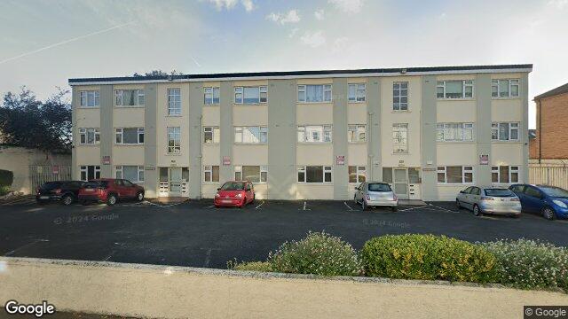
10 Drumderg Court

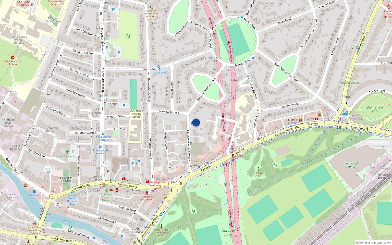
Dublin 3 / Fairview / D03RK85

Last Sale Price

€289,000
House Second-Hand 2 recorded sales 6.9 yrs tracked
vs Street
+12.9%
Median €256,000
9 sales
Growth +7.7%/yr · 7.8 yrs
vs Fairview
-11.3%
Median €325,750
242 sales
Growth +9.6%/yr · 11.6 yrs
vs Dublin 3
-28.4%
Median €403,881
5,998 sales
Growth +6.5%/yr · 16.0 yrs
Street View near 10 Drumderg Court, Fairview Avenue Lower, Fairview Dublin 3
Nearby Properties
Loading map…

Sale History

2 sales
€289,000
2 years ago
Second-Hand Dwelling house /Apartment
+€134,000 (+86.5%) over 6.9 yrs
€155,000
8 yrs, 11 mo ago
Second-Hand Dwelling house /Apartment

Overall: +86.5% from €155,000 to €289,000 ()


Price History

Loading chart…

Price Intelligence

This property has been sold 2 times since 29 Mar 2017. The price has increased by +86.5% from €155,000 to €289,000. That works out to an annualised return of +9.4% over 6.9 years.

At €289,000, 10 Drumderg Court last sold 12.9% above the Fairview Avenue Lower street median of €256,000 (based on 9 recorded sales). Compared to Fairview overall (median €325,750, 242 sales), 10 Drumderg Court sits 11.3% below the area average.

Repeat-sale properties on Fairview Avenue Lower show a median investment growth rate of +7.7% per year over 7.8 years (2017 to 2025, 3 repeat-sale properties).

Street Rank
Top 44%
of 9 properties
€145,000 Street range €850,000
This property: €289,000
What did 10 Drumderg Court last sell for?

10 Drumderg Court last sold for €289,000 on 14 Feb 2024.

How many times has 10 Drumderg Court been sold?

10 Drumderg Court has been sold 2 times between 29 Mar 2017 and 14 Feb 2024. The price increased by 86.5% over that period.

How does 10 Drumderg Court compare to others near Fairview Avenue Lower?

At €289,000, 10 Drumderg Court last sold 12.9% above the Fairview Avenue Lower street median of €256,000 (based on 9 recorded sales).

How does 10 Drumderg Court compare to the rest of Fairview?

Compared to Fairview (median €325,750, 242 sales), 10 Drumderg Court sits 11.3% below the area average.

What is the investment growth rate on Fairview Avenue Lower?

Using properties on Fairview Avenue Lower with at least two recorded sales, the median annual growth rate is +7.7% per year over 7.8 years (2017 to 2025, 3 repeat-sale properties). How this is calculated.

Growth metrics use repeat-sale properties only. Methodology.
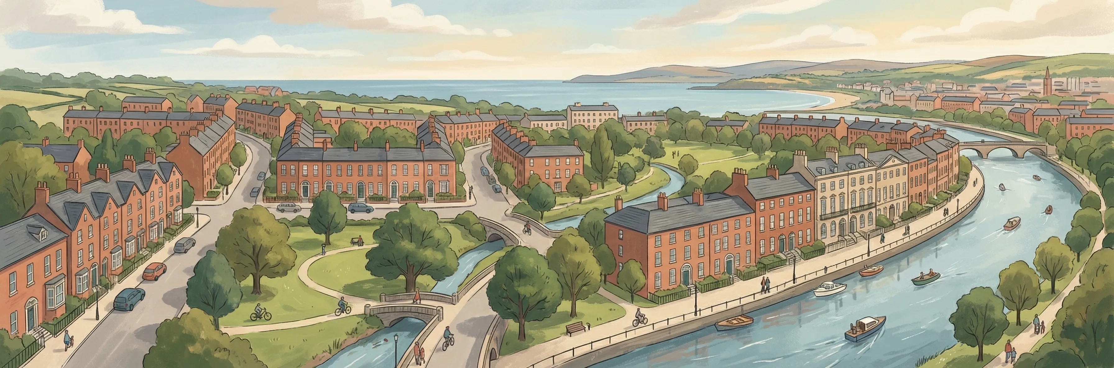
Fairview streetscape

About Fairview

Fairview is a neighbourhood in Dublin 3, Dublin.

Area Median
€325,750
242 sales
District Median
€403,881
5,998 sales
Street Median
€256,000
9 sales

Housing in Dublin 3

Typical Size
80 m²
Typical Build
1959
BER Ratings
A (efficient)G

Based on 11,869 BER assessments — see district details

Related Pages

Debug: Address & Geocode Data

Composed Display Address

10 Drumderg Court, Fairview Avenue Lower, Fairview Dublin 3

PPR Source

address 10 DRUMDERG COURT, FAIRVIEW AVE LOWER, FAIRVIEW DUBLIN 3
canonical_address 10 DRUMDERG COURT, FAIRVIEW AVE LOWER, FAIRVIEW DUBLIN 3
eircode (PPR) D03RK85
property_id 4ce3b344ccc972543d7af721a2da3b056f2d19c6
region dublin-03
format_display_address() 10 Drumderg Court, Fairview Avenue Lower, Fairview Dublin 3

Parsed Address (URL Gen)

district dublin-03
district_display Dublin 3
area fairview
area_display Fairview
street fairview-avenue-lower
street_display Fairview Avenue Lower
house_number 10
slug 10-drumderg-court-fairview-ave-lower-fairview
is_apartment false

Geocode Data

source_provider google
source_accuracy APPROXIMATE
latitude 53.3643649
longitude -6.2357451
formatted_address Dublin, Co. Dublin, D03 RK85, Ireland
eircode (geocode) D03RK85
locality Dublin
county County Dublin
resolution_method conflict_unresolved_google_default
street_number
route
sublocality
address_components
show raw JSON
[{"long_name": "D03 RK85", "short_name": "D03 RK85", "types": ["postal_code"]}, {"long_name": "Dublin", "short_name": "Dublin", "types": ["locality", "political"]}, {"long_name": "County Dublin", "short_name": "D", "types": ["administrative_area_level_1", "political"]}, {"long_name": "Ireland", "short_name": "IE", "types": ["country", "political"]}]

Provider Geocode Payloads

Google ok
query_text D03RK85, Ireland
fetched_at 2026-02-13T16:01:49Z
formatted_address Dublin, Co. Dublin, D03 RK85, Ireland
eircode D03RK85
locality Dublin
county County Dublin
street_number
route
sublocality
latitude 53.3643649
longitude -6.2357451
address_components
show raw JSON
[
  {
    "long_name": "D03 RK85",
    "short_name": "D03 RK85",
    "types": [
      "postal_code"
    ]
  },
  {
    "long_name": "Dublin",
    "short_name": "Dublin",
    "types": [
      "locality",
      "political"
    ]
  },
  {
    "long_name": "County Dublin",
    "short_name": "D",
    "types": [
      "administrative_area_level_1",
      "political"
    ]
  },
  {
    "long_name": "Ireland",
    "short_name": "IE",
    "types": [
      "country",
      "political"
    ]
  }
]
raw_payload
show raw JSON
{
  "accuracy": "APPROXIMATE",
  "address_components": [
    {
      "long_name": "D03 RK85",
      "short_name": "D03 RK85",
      "types": [
        "postal_code"
      ]
    },
    {
      "long_name": "Dublin",
      "short_name": "Dublin",
      "types": [
        "locality",
        "political"
      ]
    },
    {
      "long_name": "County Dublin",
      "short_name": "D",
      "types": [
        "administrative_area_level_1",
        "political"
      ]
    },
    {
      "long_name": "Ireland",
      "short_name": "IE",
      "types": [
        "country",
        "political"
      ]
    }
  ],
  "country_code": "ie",
  "county": "County Dublin",
  "eircode": "D03RK85",
  "formatted_address": "Dublin, Co. Dublin, D03 RK85, Ireland",
  "lat": 53.3643649,
  "locality": "Dublin",
  "lon": -6.2357451,
  "place_id": "ChIJid0BwFsOZ0gRB1-B_kQ9f80",
  "provider": "google",
  "route": "",
  "street_number": "",
  "sublocality": ""
}
Nominatim ok
query_text D03RK85, Ireland
fetched_at 2026-02-14T16:10:41Z
formatted_address National Library of Ireland, 7/8, Kildare Street, Mansion House B ED, Dublin, County Dublin, Leinster, D02 P638, Éire / Ireland
eircode D02P638
locality Dublin
county County Dublin
street_number 7/8
route Kildare Street
sublocality
latitude 53.3411249
longitude -6.2545
address_components
show raw JSON
{
  "ISO3166-2-lvl5": "IE-L",
  "ISO3166-2-lvl6": "IE-D",
  "amenity": "National Library of Ireland",
  "city": "Dublin",
  "city_district": "Mansion House B ED",
  "country": "\u00c9ire / Ireland",
  "country_code": "ie",
  "county": "County Dublin",
  "house_number": "7/8",
  "postcode": "D02 P638",
  "region": "Leinster",
  "road": "Kildare Street"
}
raw_payload
show raw JSON
{
  "accuracy": "library",
  "address_components": {
    "ISO3166-2-lvl5": "IE-L",
    "ISO3166-2-lvl6": "IE-D",
    "amenity": "National Library of Ireland",
    "city": "Dublin",
    "city_district": "Mansion House B ED",
    "country": "\u00c9ire / Ireland",
    "country_code": "ie",
    "county": "County Dublin",
    "house_number": "7/8",
    "postcode": "D02 P638",
    "region": "Leinster",
    "road": "Kildare Street"
  },
  "country_code": "ie",
  "county": "County Dublin",
  "eircode": "D02P638",
  "formatted_address": "National Library of Ireland, 7/8, Kildare Street, Mansion House B ED, Dublin, County Dublin, Leinster, D02 P638, \u00c9ire / Ireland",
  "lat": 53.3411249,
  "locality": "Dublin",
  "lon": -6.2545,
  "place_id": "255244705",
  "provider": "nominatim",
  "route": "Kildare Street",
  "street_number": "7/8",
  "sublocality": ""
}

Composition Path

Formatted address cleaned formatted_address (stripped ", Ireland" and Eircode)

Eircode Resolution

PPR eircode D03RK85
Geocode eircode D03RK85
best_eircode (used) D03RK85

BER Data (no BER match)

No BER data matched for this property.

Computed Metrics

property_type Second-Hand
dwelling_type House
size_description None
holding_years 6.9
annualized_pct 9.4
vs_street_median_pct 12.9
street_median 256000
street_sample_size 9
street_is_reliable true
vs_area_median_pct -11.3
area_median 325750
area_sample_size 242
area_is_reliable true
vs_district_median_pct -28.4
district_median 403881
district_sample_size 5998
district_is_reliable true
street_growth_rate_pct 7.7
street_growth_years 7.8
street_growth_sample_size 3
area_growth_rate_pct 9.6
area_growth_years 11.6
area_growth_sample_size 25
district_growth_rate_pct 6.5
district_growth_years 16.0
district_growth_sample_size 692
nearby_avg_price None
nearby_price_range None
nearby_count 0