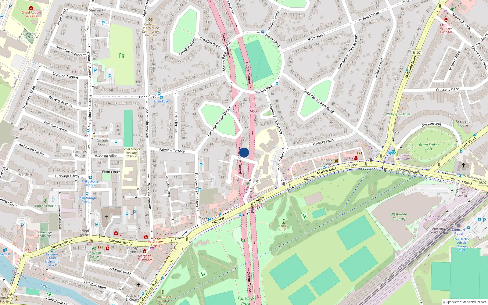
22 Merville Avenue

Dublin 3 / Fairview / D03E3H9

Last Sale Price

€470,000

* Not full market price · Learn more →

House Second-Hand 1 recorded sale
Street View near 22 Merville Avenue, Fairview, Dublin 3
Nearby Properties
Loading map…

Sale History

1 sale
€470,000
2 years ago
Second-Hand Dwelling house /Apartment

Price Intelligence

This property has one recorded sale for €470,000 on 13 Feb 2024.

Street Rank
Top 11%
of 9 properties
Area Rank
Top 25%
of 242 properties
€280,000 Street range €1,250,000
This property: €470,000
What did 22 Merville Avenue last sell for?

22 Merville Avenue last sold for €470,000 on 13 Feb 2024.

How does 22 Merville Avenue compare to others near Merville Avenue?

At €470,000, 22 Merville Avenue last sold 27.0% above the Merville Avenue street median of €370,000 (based on 9 recorded sales).

How does 22 Merville Avenue compare to the rest of Fairview?

Compared to Fairview (median €325,750, 242 sales), 22 Merville Avenue sits 44.3% above the area average.

Growth metrics use repeat-sale properties only. Methodology.
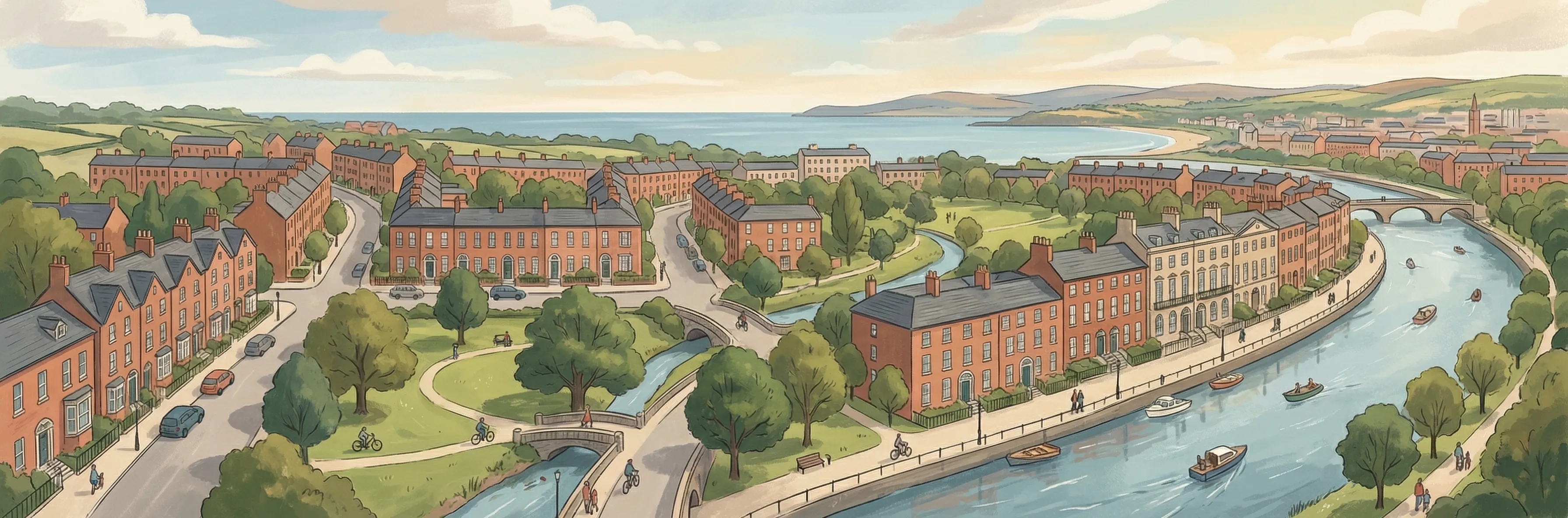
Fairview streetscape

About Fairview

Fairview is a neighbourhood in Dublin 3, Dublin.

Area Median
€325,750
242 sales
District Median
€403,881
5,998 sales
Street Median
€370,000
9 sales

Housing in Dublin 3

Typical Size
80 m²
Typical Build
1959
BER Ratings
A (efficient)G

Based on 11,869 BER assessments — see district details

Related Pages

Debug: Address & Geocode Data

Composed Display Address

22 Merville Avenue, Fairview, Dublin 3

PPR Source

address 22 MERVILLE AVE, FAIRVIEW, DUBLIN 3
canonical_address 22 MERVILLE AVE, FAIRVIEW, DUBLIN 3
eircode (PPR) D03E3H9
property_id 61093e414afa5f0f06b370dc19926d3555ac8e88
region dublin-03
format_display_address() 22 Merville Avenue, Fairview, Dublin 3

Parsed Address (URL Gen)

district dublin-03
district_display Dublin 3
area fairview
area_display Fairview
street merville-avenue
street_display Merville Avenue
house_number 22
slug 22-merville-ave-fairview
is_apartment false

Geocode Data

source_provider google
source_accuracy APPROXIMATE
latitude 53.3645948
longitude -6.2344113
formatted_address Dublin, Co. Dublin, D03 E3H9, Ireland
eircode (geocode) D03E3H9
locality Dublin
county County Dublin
resolution_method conflict_unresolved_google_default
street_number
route
sublocality
address_components
show raw JSON
[{"long_name": "D03 E3H9", "short_name": "D03 E3H9", "types": ["postal_code"]}, {"long_name": "Dublin", "short_name": "Dublin", "types": ["locality", "political"]}, {"long_name": "County Dublin", "short_name": "D", "types": ["administrative_area_level_1", "political"]}, {"long_name": "Ireland", "short_name": "IE", "types": ["country", "political"]}]

Provider Geocode Payloads

Google ok
query_text D03E3H9, Ireland
fetched_at 2026-02-13T16:01:49Z
formatted_address Dublin, Co. Dublin, D03 E3H9, Ireland
eircode D03E3H9
locality Dublin
county County Dublin
street_number
route
sublocality
latitude 53.3645948
longitude -6.2344113
address_components
show raw JSON
[
  {
    "long_name": "D03 E3H9",
    "short_name": "D03 E3H9",
    "types": [
      "postal_code"
    ]
  },
  {
    "long_name": "Dublin",
    "short_name": "Dublin",
    "types": [
      "locality",
      "political"
    ]
  },
  {
    "long_name": "County Dublin",
    "short_name": "D",
    "types": [
      "administrative_area_level_1",
      "political"
    ]
  },
  {
    "long_name": "Ireland",
    "short_name": "IE",
    "types": [
      "country",
      "political"
    ]
  }
]
raw_payload
show raw JSON
{
  "accuracy": "APPROXIMATE",
  "address_components": [
    {
      "long_name": "D03 E3H9",
      "short_name": "D03 E3H9",
      "types": [
        "postal_code"
      ]
    },
    {
      "long_name": "Dublin",
      "short_name": "Dublin",
      "types": [
        "locality",
        "political"
      ]
    },
    {
      "long_name": "County Dublin",
      "short_name": "D",
      "types": [
        "administrative_area_level_1",
        "political"
      ]
    },
    {
      "long_name": "Ireland",
      "short_name": "IE",
      "types": [
        "country",
        "political"
      ]
    }
  ],
  "country_code": "ie",
  "county": "County Dublin",
  "eircode": "D03E3H9",
  "formatted_address": "Dublin, Co. Dublin, D03 E3H9, Ireland",
  "lat": 53.3645948,
  "locality": "Dublin",
  "lon": -6.2344113,
  "place_id": "ChIJTYnOtVsOZ0gRSSyGcFrNCIk",
  "provider": "google",
  "route": "",
  "street_number": "",
  "sublocality": ""
}
Nominatim ok
query_text D03E3H9, Ireland
fetched_at 2026-02-14T16:10:39Z
formatted_address National Library of Ireland, 7/8, Kildare Street, Mansion House B Ward 1986, Dublin, County Dublin, Leinster, D02 P638, Éire / Ireland
eircode D02P638
locality Dublin
county County Dublin
street_number 7/8
route Kildare Street
sublocality
latitude 53.3411249
longitude -6.2545
address_components
show raw JSON
{
  "ISO3166-2-lvl5": "IE-L",
  "ISO3166-2-lvl6": "IE-D",
  "amenity": "National Library of Ireland",
  "city": "Dublin",
  "city_district": "Mansion House B Ward 1986",
  "country": "\u00c9ire / Ireland",
  "country_code": "ie",
  "county": "County Dublin",
  "house_number": "7/8",
  "postcode": "D02 P638",
  "region": "Leinster",
  "road": "Kildare Street"
}
raw_payload
show raw JSON
{
  "accuracy": "library",
  "address_components": {
    "ISO3166-2-lvl5": "IE-L",
    "ISO3166-2-lvl6": "IE-D",
    "amenity": "National Library of Ireland",
    "city": "Dublin",
    "city_district": "Mansion House B Ward 1986",
    "country": "\u00c9ire / Ireland",
    "country_code": "ie",
    "county": "County Dublin",
    "house_number": "7/8",
    "postcode": "D02 P638",
    "region": "Leinster",
    "road": "Kildare Street"
  },
  "country_code": "ie",
  "county": "County Dublin",
  "eircode": "D02P638",
  "formatted_address": "National Library of Ireland, 7/8, Kildare Street, Mansion House B Ward 1986, Dublin, County Dublin, Leinster, D02 P638, \u00c9ire / Ireland",
  "lat": 53.3411249,
  "locality": "Dublin",
  "lon": -6.2545,
  "place_id": "256017403",
  "provider": "nominatim",
  "route": "Kildare Street",
  "street_number": "7/8",
  "sublocality": ""
}

Composition Path

Formatted address cleaned formatted_address (stripped ", Ireland" and Eircode)

Eircode Resolution

PPR eircode D03E3H9
Geocode eircode D03E3H9
best_eircode (used) D03E3H9

BER Data (no BER match)

No BER data matched for this property.

Computed Metrics

property_type Second-Hand
dwelling_type House
size_description None
holding_years None
annualized_pct None
vs_street_median_pct 27.0
street_median 370000
street_sample_size 9
street_is_reliable true
vs_area_median_pct 44.3
area_median 325750
area_sample_size 242
area_is_reliable true
vs_district_median_pct 16.4
district_median 403881
district_sample_size 5998
district_is_reliable true
street_growth_rate_pct None
street_growth_years None
street_growth_sample_size 0
area_growth_rate_pct 9.6
area_growth_years 11.6
area_growth_sample_size 25
district_growth_rate_pct 6.5
district_growth_years 16.0
district_growth_sample_size 692
nearby_avg_price None
nearby_price_range None
nearby_count 0