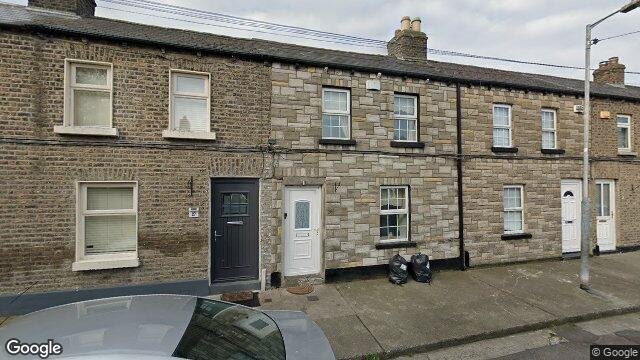
28 Kings Avenue

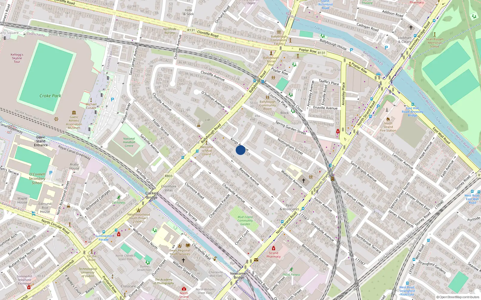
Dublin 3 / Ballybough / D03HK28

Last Sale Price

€305,000
House Second-Hand 2 recorded sales 0.5 yrs tracked
vs Street
+153.1%
Median €120,500
8 sales
Growth +12.5%/yr · 10.5 yrs
vs Ballybough
+35.0%
Median €226,000
67 sales
Growth +12.5%/yr · 11.9 yrs
vs Dublin 3
-24.5%
Median €403,881
5,998 sales
Growth +6.5%/yr · 16.0 yrs
Street View near 28 Kings Avenue, Ballybough, Dublin 3
Nearby Properties
Loading map…

Sale History

2 sales
€305,000
4 years ago
Second-Hand Dwelling house /Apartment
+€63,000 (+26.0%) over 0.5 yrs
€242,000
4 yrs, 6 mo ago
Second-Hand Dwelling house /Apartment

Overall: +26.0% from €242,000 to €305,000 ()


Price History

Loading chart…

Price Intelligence

This property has been sold 2 times since 27 Aug 2021. The price has increased by +26.0% from €242,000 to €305,000.

At €305,000, 28 Kings Avenue last sold 153.1% above the Kings Avenue street median of €120,500 (based on 8 recorded sales). Compared to Ballybough overall (median €226,000, 67 sales), 28 Kings Avenue sits 35.0% above the area average.

Repeat-sale properties on Kings Avenue show a median investment growth rate of +12.5% per year over 10.5 years (2013 to 2024, 2 repeat-sale properties).

Street Rank
Top 12%
of 8 properties
Area Rank
Top 22%
of 67 properties
€5,715 Street range €305,000
This property: €305,000
What did 28 Kings Avenue last sell for?

28 Kings Avenue last sold for €305,000 on 10 Feb 2022.

How many times has 28 Kings Avenue been sold?

28 Kings Avenue has been sold 2 times between 27 Aug 2021 and 10 Feb 2022. The price increased by 26.0% over that period.

How does 28 Kings Avenue compare to others near Kings Avenue?

At €305,000, 28 Kings Avenue last sold 153.1% above the Kings Avenue street median of €120,500 (based on 8 recorded sales).

How does 28 Kings Avenue compare to the rest of Ballybough?

Compared to Ballybough (median €226,000, 67 sales), 28 Kings Avenue sits 35.0% above the area average.

What is the investment growth rate on Kings Avenue?

Using properties on Kings Avenue with at least two recorded sales, the median annual growth rate is +12.5% per year over 10.5 years (2013 to 2024, 2 repeat-sale properties). How this is calculated.

Growth metrics use repeat-sale properties only. Methodology.
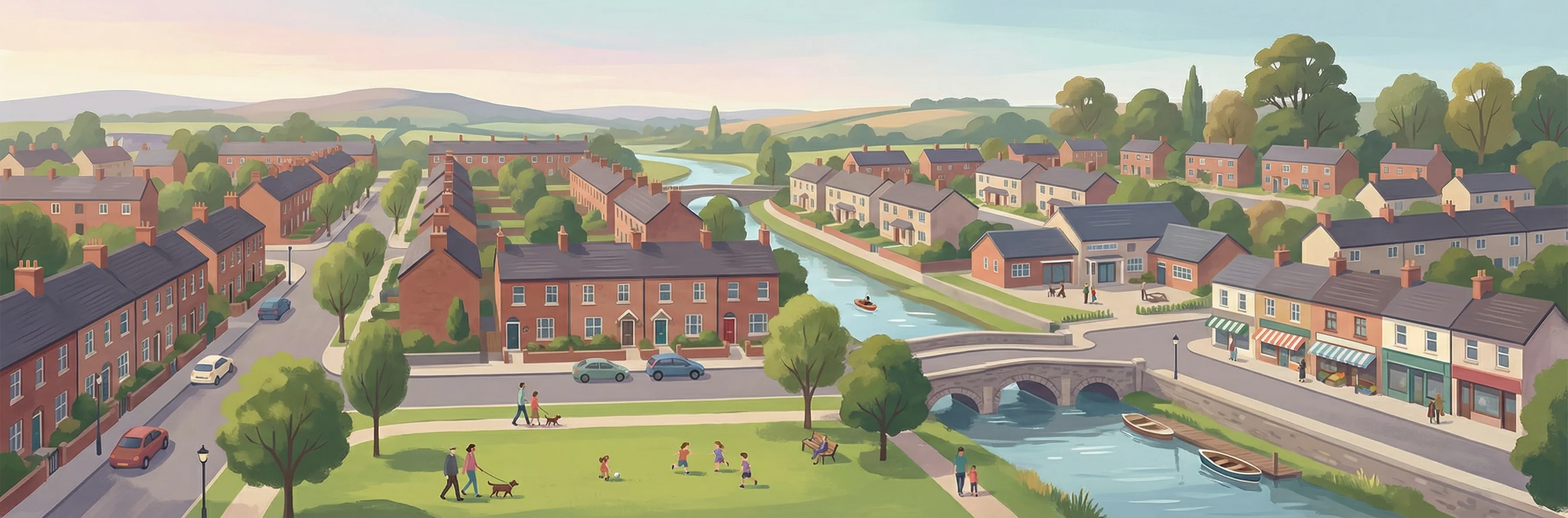
Ballybough streetscape

About Ballybough

Ballybough is a neighbourhood in Dublin 3, Dublin.

Area Median
€226,000
67 sales
District Median
€403,881
5,998 sales
Street Median
€120,500
8 sales

Housing in Dublin 3

Typical Size
80 m²
Typical Build
1959
BER Ratings
A (efficient)G

Based on 11,869 BER assessments — see district details

Related Pages

Debug: Address & Geocode Data

Composed Display Address

28 Kings Avenue, Ballybough, Dublin 3

PPR Source

address 28 KINGS AVENUE, BALLYBOUGH, DUBLIN 3
canonical_address 28 KINGS AVENUE, BALLYBOUGH, DUBLIN 3
eircode (PPR) D03HK28
property_id 9caf7308cc1664bbd13d43a08e0daa25e97b43a4
region dublin-03
format_display_address() 28 Kings Avenue, Ballybough, Dublin 3

Parsed Address (URL Gen)

district dublin-03
district_display Dublin 3
area ballybough
area_display Ballybough
street kings-avenue
street_display Kings Avenue
house_number 28
slug 28-kings-avenue-ballybough
is_apartment false

Geocode Data

source_provider google
source_accuracy APPROXIMATE
latitude 53.3591986
longitude -6.244191900000001
formatted_address Dublin, Co. Dublin, D03 HK28, Ireland
eircode (geocode) D03HK28
locality Dublin
county County Dublin
resolution_method conflict_unresolved_google_default
street_number
route
sublocality
address_components
show raw JSON
[{"long_name": "D03 HK28", "short_name": "D03 HK28", "types": ["postal_code"]}, {"long_name": "Dublin", "short_name": "Dublin", "types": ["locality", "political"]}, {"long_name": "County Dublin", "short_name": "D", "types": ["administrative_area_level_1", "political"]}, {"long_name": "Ireland", "short_name": "IE", "types": ["country", "political"]}]

Provider Geocode Payloads

Google ok
query_text D03HK28, Ireland
fetched_at 2026-02-13T15:57:30Z
formatted_address Dublin, Co. Dublin, D03 HK28, Ireland
eircode D03HK28
locality Dublin
county County Dublin
street_number
route
sublocality
latitude 53.3591986
longitude -6.244191900000001
address_components
show raw JSON
[
  {
    "long_name": "D03 HK28",
    "short_name": "D03 HK28",
    "types": [
      "postal_code"
    ]
  },
  {
    "long_name": "Dublin",
    "short_name": "Dublin",
    "types": [
      "locality",
      "political"
    ]
  },
  {
    "long_name": "County Dublin",
    "short_name": "D",
    "types": [
      "administrative_area_level_1",
      "political"
    ]
  },
  {
    "long_name": "Ireland",
    "short_name": "IE",
    "types": [
      "country",
      "political"
    ]
  }
]
raw_payload
show raw JSON
{
  "accuracy": "APPROXIMATE",
  "address_components": [
    {
      "long_name": "D03 HK28",
      "short_name": "D03 HK28",
      "types": [
        "postal_code"
      ]
    },
    {
      "long_name": "Dublin",
      "short_name": "Dublin",
      "types": [
        "locality",
        "political"
      ]
    },
    {
      "long_name": "County Dublin",
      "short_name": "D",
      "types": [
        "administrative_area_level_1",
        "political"
      ]
    },
    {
      "long_name": "Ireland",
      "short_name": "IE",
      "types": [
        "country",
        "political"
      ]
    }
  ],
  "country_code": "ie",
  "county": "County Dublin",
  "eircode": "D03HK28",
  "formatted_address": "Dublin, Co. Dublin, D03 HK28, Ireland",
  "lat": 53.3591986,
  "locality": "Dublin",
  "lon": -6.244191900000001,
  "place_id": "ChIJSyqoemAOZ0gR49mJrtowCr8",
  "provider": "google",
  "route": "",
  "street_number": "",
  "sublocality": ""
}
Nominatim ok
query_text D03HK28, Ireland
fetched_at 2026-02-14T15:38:15Z
formatted_address National Library of Ireland, 7/8, Kildare Street, Mansion House B Ward 1986, Dublin, County Dublin, Leinster, D02 P638, Éire / Ireland
eircode D02P638
locality Dublin
county County Dublin
street_number 7/8
route Kildare Street
sublocality
latitude 53.3411249
longitude -6.2545
address_components
show raw JSON
{
  "ISO3166-2-lvl5": "IE-L",
  "ISO3166-2-lvl6": "IE-D",
  "amenity": "National Library of Ireland",
  "city": "Dublin",
  "city_district": "Mansion House B Ward 1986",
  "country": "\u00c9ire / Ireland",
  "country_code": "ie",
  "county": "County Dublin",
  "house_number": "7/8",
  "postcode": "D02 P638",
  "region": "Leinster",
  "road": "Kildare Street"
}
raw_payload
show raw JSON
{
  "accuracy": "library",
  "address_components": {
    "ISO3166-2-lvl5": "IE-L",
    "ISO3166-2-lvl6": "IE-D",
    "amenity": "National Library of Ireland",
    "city": "Dublin",
    "city_district": "Mansion House B Ward 1986",
    "country": "\u00c9ire / Ireland",
    "country_code": "ie",
    "county": "County Dublin",
    "house_number": "7/8",
    "postcode": "D02 P638",
    "region": "Leinster",
    "road": "Kildare Street"
  },
  "country_code": "ie",
  "county": "County Dublin",
  "eircode": "D02P638",
  "formatted_address": "National Library of Ireland, 7/8, Kildare Street, Mansion House B Ward 1986, Dublin, County Dublin, Leinster, D02 P638, \u00c9ire / Ireland",
  "lat": 53.3411249,
  "locality": "Dublin",
  "lon": -6.2545,
  "place_id": "256017403",
  "provider": "nominatim",
  "route": "Kildare Street",
  "street_number": "7/8",
  "sublocality": ""
}

Composition Path

Formatted address cleaned formatted_address (stripped ", Ireland" and Eircode)

Eircode Resolution

PPR eircode D03HK28
Geocode eircode D03HK28
best_eircode (used) D03HK28

BER Data (no BER match)

No BER data matched for this property.

Computed Metrics

property_type Second-Hand
dwelling_type House
size_description None
holding_years 0.5
annualized_pct None
vs_street_median_pct 153.1
street_median 120500
street_sample_size 8
street_is_reliable true
vs_area_median_pct 35.0
area_median 226000
area_sample_size 67
area_is_reliable true
vs_district_median_pct -24.5
district_median 403881
district_sample_size 5998
district_is_reliable true
street_growth_rate_pct 12.5
street_growth_years 10.5
street_growth_sample_size 2
area_growth_rate_pct 12.5
area_growth_years 11.9
area_growth_sample_size 6
district_growth_rate_pct 6.5
district_growth_years 16.0
district_growth_sample_size 692
nearby_avg_price None
nearby_price_range None
nearby_count 0